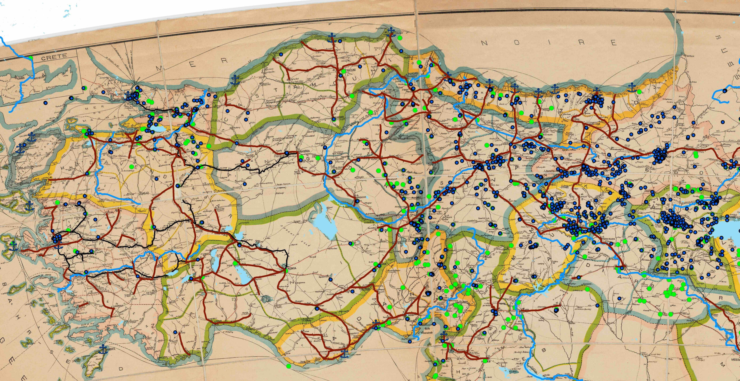
Social Scientific Applications of Historical GIS, Part 1: Digitizing Historical Maps and Creating District Polygons in ArcGIS
This post has been contributed by Emre Amasyali. Information about the author is included at the end of the post.…
This post has been contributed by Emre Amasyali. Information about the author is included at the end of the post.…